Have it delivered hassle-freeBuyer protectionAll Designer items curated by WhoppahDownload the Whoppah App – get alerts & sell with ease.


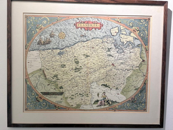


Flandria by Abraham Ortelius
€200Bid from €195
Buy with confidence
Shop & pay safely with Buyer ProtectionDesigner items curated by WhoppahWe only pay the seller once you have safely received the itemTrusted payment methods


About this seller
Private sellerProduct description
This is a framed, antique copper engraving of the County of Flanders, known as "Flandria", created by the famous cartographer Abraham Ortelius between 1570 and 1584. Features: The map is known for its unique egg-shaped (oval) border, decorated with sailing ships, sea monsters, and a compass rose. Historical value: Ortelius' Theatrum Orbis Terrarum, of which this map is a part, is considered the first modern world atlas. Origin: The map is based on an earlier map of Flanders by Gerardus Mercator from 1540.
Specifications
ConditionVery goodColorsMulti ColorMaterialPaperNumber of items1Height46 cmWidth65 cmDepth1 cm
Discover more
Seller information
About this seller
Private sellerLeusden, NetherlandsOn Whoppah since June 2023 • 0 sales