Have it delivered hassle-freeBuyer protectionAll Designer items curated by WhoppahDownload the Whoppah App – get alerts & sell with ease.
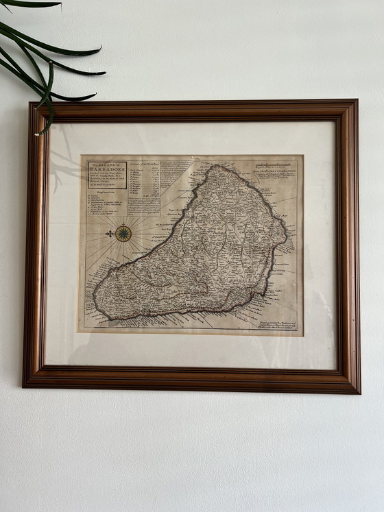
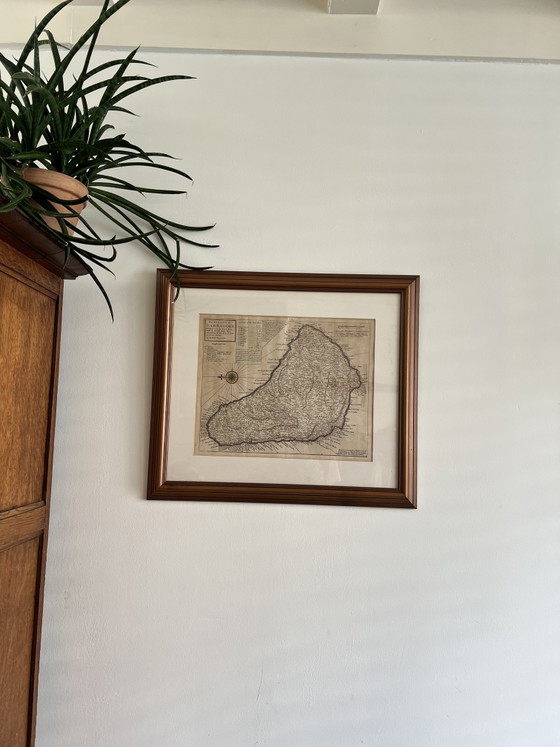

Antieke ingelijste kaart "The Island of Barbadoes" – Herman Moll (ca. 1720)
€275Bid from €200
Buy with confidence
Shop & pay safely with Buyer ProtectionDesigner items curated by WhoppahWe only pay the seller once you have safely received the itemTrusted payment methods


About this seller
Private sellerProduct description
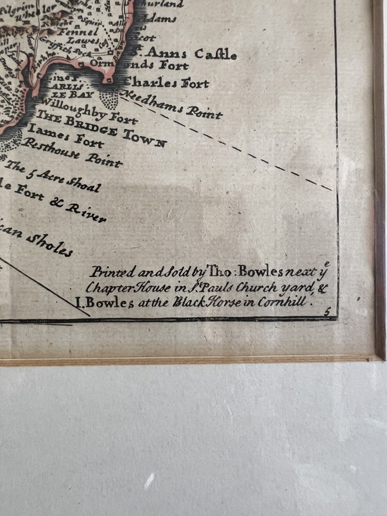
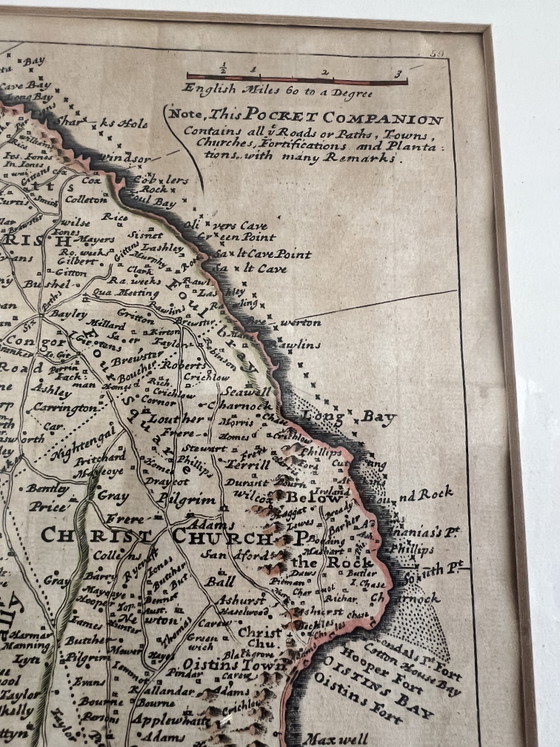
A beautiful piece of Caribbean history seeking a good home. It is with a sentimental heart that I am parting with this exceptional, original 18th-century map of Barbados ("The Island of Barbadoes"), created by the renowned English geographer Herman Moll around 1720.
As a Barbadian, this map has always held a deeply profound personal meaning for me. I originally purchased this authentic piece from the highly regarded The Antique Paper Company in Angel, Islington (London).
To ensure its preservation, I had it professionally framed to protect it from dust, light, and age.
Because I do not have children to pass this heirloom down to, it is my sincere wish that it goes to a wonderful new home where it will be truly cherished and looked after.
About the Map:
Cartographer: Herman Moll (1654–1732)Period: Early 18th Century (circa 1720)
Historical Details:
Richly detailed, showing the island's early parish divisions, historic roads, sugar mills, and coastal topography.
Framing & Condition:
The map is professionally preserved with high-quality matting and housed in a premium, fluted warm-toned wooden frame featuring an elegant metallic inner lip. The custom framing was entirely done for protection, meaning it is in pristine vintage condition and ready to hang as a sophisticated focal piece.
Specifications
ConditionExcellentColorsBeigeMaterialPaperNumber of items1OrientationLandscapeArt sizeMediumHeight51 cmWidth58 cm
Discover more
Seller information
About this seller
Private sellerZaandam, NetherlandsOn Whoppah since December 2024 • 0 sales