Have it delivered hassle-freeBuyer protectionAll Designer items curated by WhoppahDownload the Whoppah App – get alerts & sell with ease.
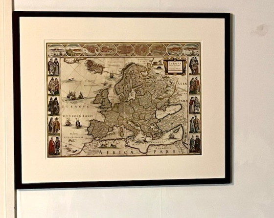
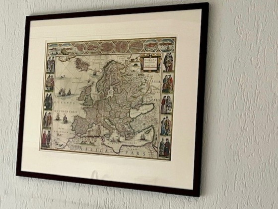
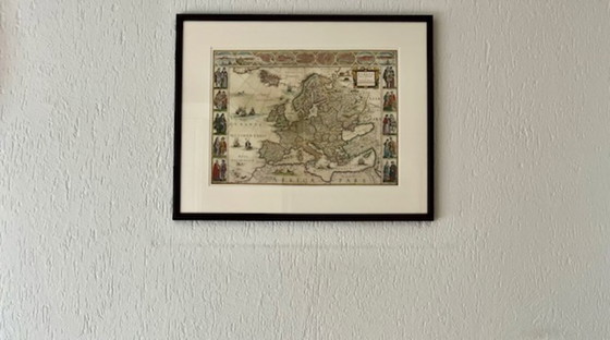

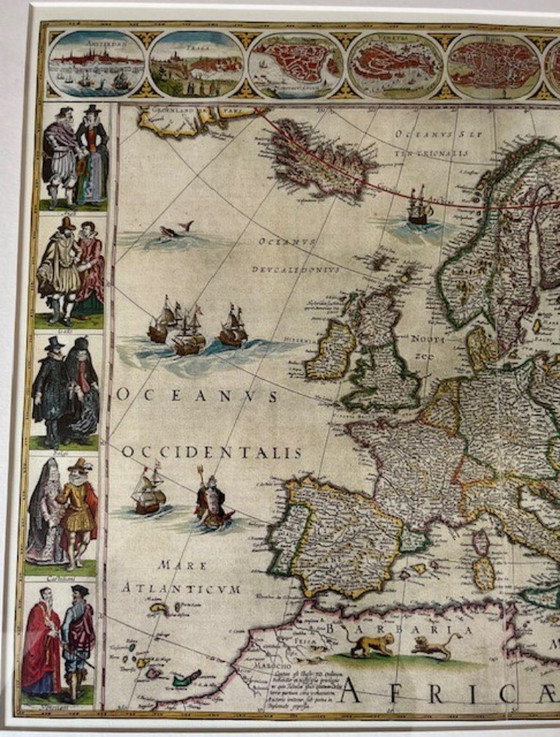
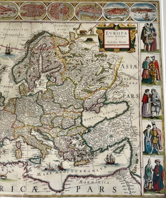
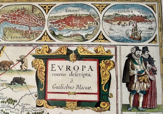
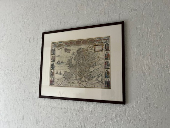
Europe map by G. Blaeuw
€140Bid from €100
Buy with confidence
Shop & pay safely with Buyer ProtectionDesigner items curated by WhoppahWe only pay the seller once you have safely received the itemTrusted payment methods


About this seller
Private sellerEmmer-Compascuum, NetherlandsOn Whoppah since February 2023 • 13 sales
Product description
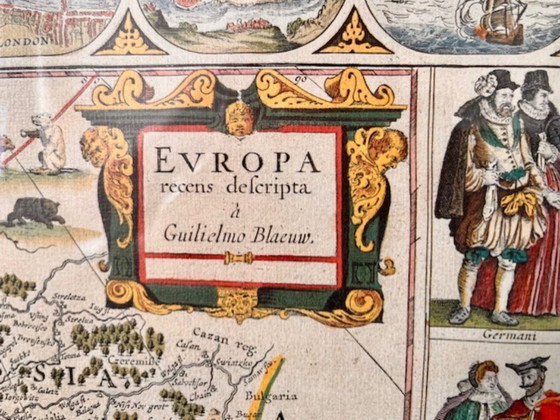
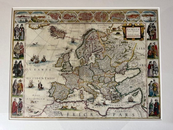
Blaeu's Europe or the continent's finest.
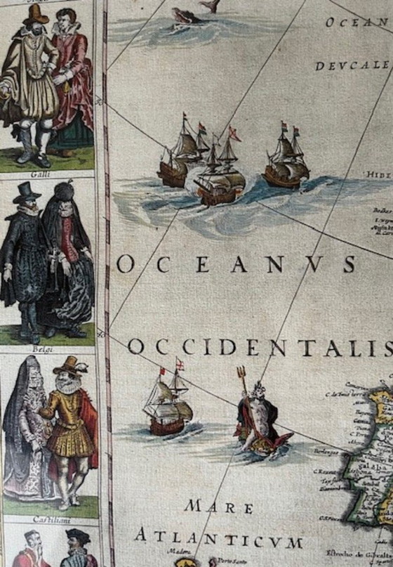
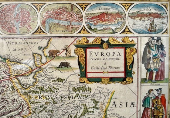
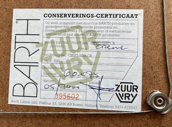
In the horizontal bands city views were added; In the vertical lines regional people in costume. Ortelius had already cautiously dealt with this issue. Willem Blaeu's (see two engravings) map of Europe was first published in 1617 and was included in all of his major atlases. This map became very popular and also appeared in the Atlas Maior, the most famous world atlas, published much later by his son Joan in... 1662. The upper frieze illustrates the then relative importance of some of the cities shown (obviously as selected by William): Amsterdam, Prague, Constantinople, Venice, Rome, Paris, London, Toledo and Lisbon. But we miss Vienna, Madrid, Brussels or Antwerp! The "figures" (in the vertical bands) show a local man and woman (for Venice two men) of the regional people in lavish costumes. The (replica) painting is in a passe-partout in a mahogany-colored wooden frame. Is certified "Acid Free.
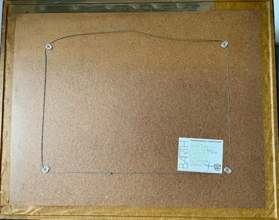
There are some small scratches on the frame, which are not noticeable.
There are some small scratches on the frame, which are not noticeable.
Specifications
ConditionVery goodColorsMulti ColorMaterialWoodNumber of items1First ownerYesOrientationLandscapeArt sizeMediumHeight63 cmWidth78 cmSigns of usageScratches
Discover more
Seller information
About this seller
Private sellerEmmer-Compascuum, NetherlandsOn Whoppah since February 2023 • 13 sales