Faites-vous livrer sans souciProtection acheteurs100% des articles Designer sélectionnésTéléchargez l’App Whoppah. Toujours informé.
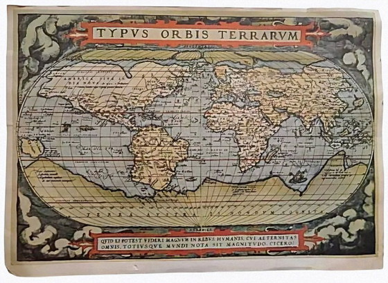
Hand-Colored Copperplate Nova Totius Terrarum Orbis Tabula World Map by Justus Danckerts, Amsterdam, Late 17th Century
855 €769 €-10%
Shopping sur Whoppah
Achetez et payez en toute sécurité avec notre Protection des acheteursArticles de designer, sélectionnés par WhoppahNous ne payons le vendeur que lorsque vous avez bien reçu l’objetMoyens de paiement sécurisés


À propos de ce vendeur
Vendeur particulierDescription du produit
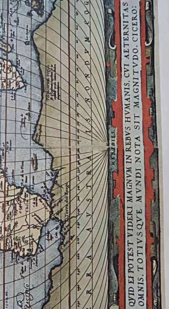
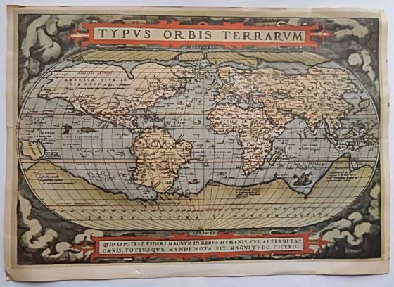
Nova Totius Terrarum Orbis Tabula – Justus Danckerts, Amsterdam, ca. 1680–1690 (Hand-Colored Copperplate World Map, Trimmed)
Exceptional decorative Baroque world map from the Dutch Golden Age – double-hemisphere projection with rich allegorical scenes in the corners (battles, discoveries, mythological figures). Original late-17th-century copperplate engraving, hand-colored, with authentic age patina and genuine traces of time. Publisher: Justus Danckerts, Amsterdam.
Detailed :
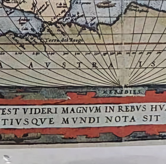
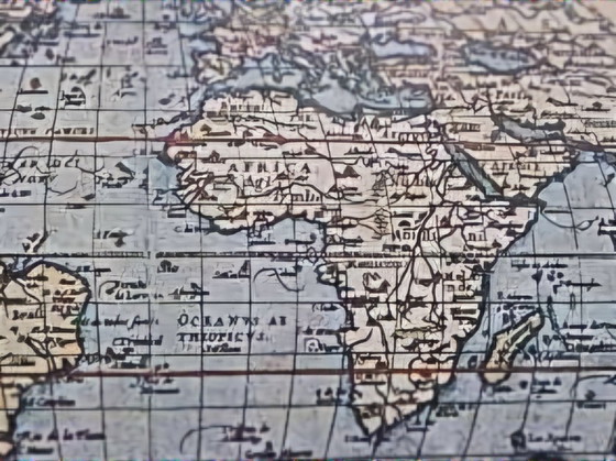
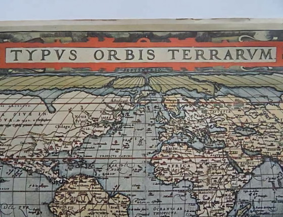
This magnificent map titled "Nova Totius Terrarum Orbis Tabula" presents the world in two main hemispheres, supplemented by two smaller polar maps and four splendid decorative vignettes in the corners symbolizing the elements, exploration, and mythology (including battle scenes, ships, exotic animals, and figures). The geography reflects the knowledge of the period: California as an island, incomplete Australia and New Zealand, and the legendary Terra Australis.
This is an **original copperplate engraving** from the workshop of Justus Danckerts (1635–1701), Amsterdam, dated approximately 1680–1690 (following the privilege "cum Privil." acquired around 1684). The title appears in a serpent wreath: "Nova Totius Terrarum Orbis Tabula Amstelodami per I. Danckerts cum Privil." – a classic variant based on Frederick de Wit's model (1668).
Dimensions & Condition:
Current measurements: 42 cm width × 30 cm height (trimmed on all sides, likely for framing or due to historical wear/damage – the original sheet measured approximately 51 × 60 cm, plate size around 48–49 × 57–58 cm, as documented in catalogs from RareMaps, Swaen, Swann Galleries, etc.). Very good for its age – hand-coloring is well preserved, patina consistent with the period (foxing, folds, slight fading), no major defects in the engraved area. Paper shows characteristics of 17th-century handmade stock.
Historical Context:
One of the most decorative world maps from the Dutch Golden Age, often compared to works by Blaeu or de Wit. It represents the transitional period before Cook's voyages – perfect for collectors, interior designers, or lovers of maritime history.
Provenance:
Formerly in a European private collection; acquired 1920s on the Vienna antiques market (Austria). The object has been in Europe for several decades.
Caractéristiques
ÉtatBonCouleursMulticoloreMatériauPapierQuantité1OrientationPortraitDimensionsPetitHauteur42 cmLargeur30 cm
Découvrir plus
Informations sur le vendeur
À propos de ce vendeur
Vendeur particulierMurska Sobota, SlovénieSur Whoppah depuis mars 2026 • 0 ventes